Satellite remote sensing technology assists in precise monitoring of forest status
Large-scale monitoring of saplings and young trees has always been difficult. Traditional satellite monitoring methods often fail to detect trees below 5 meters in height, resulting in stakeholders being 'unaware' of their investment status.
The existing monitoring methods, such as on-site inspection, drone surveys, or viewing high-resolution optical images, are not only time-consuming and expensive, but also difficult to apply on a Large-scale in multiple planting sites.
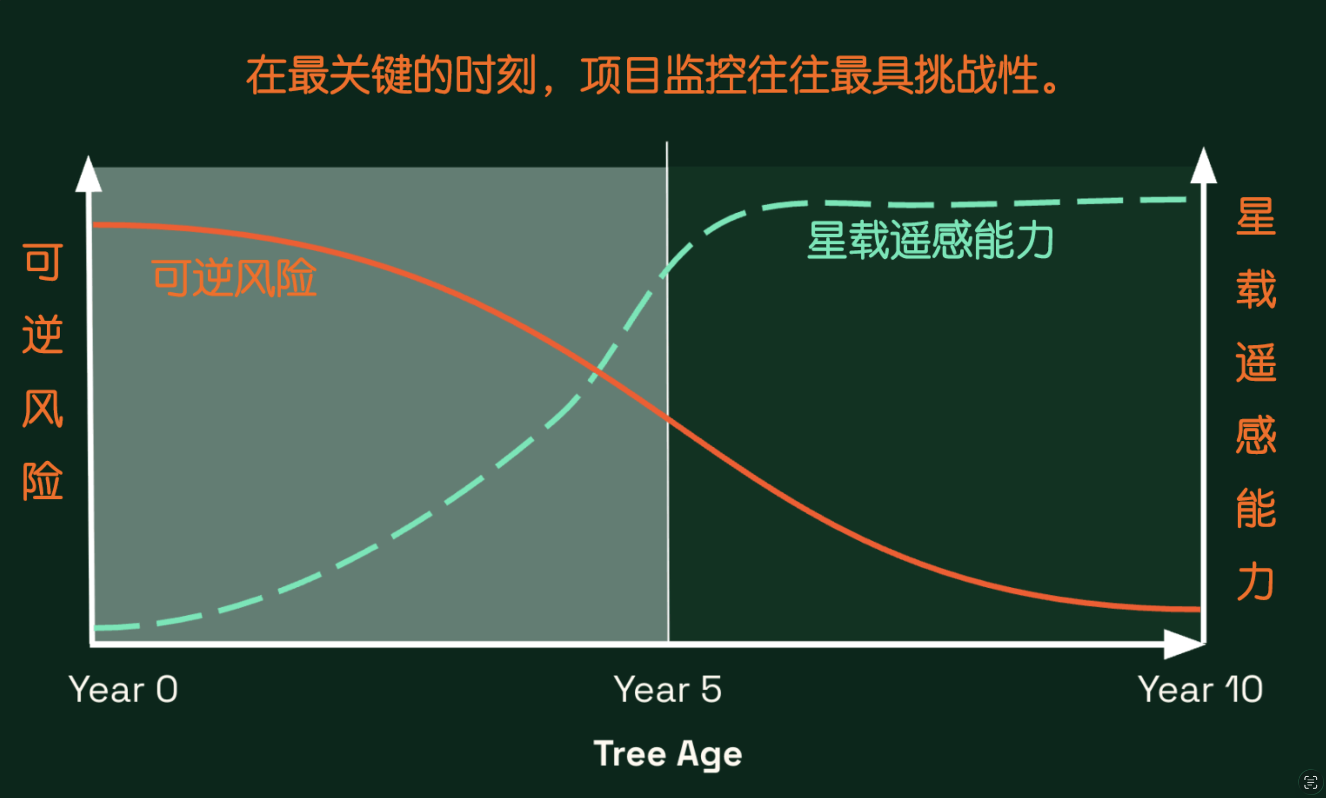
GrowthTracker is the first commercial-grade remote sensing solution designed specifically to eliminate this monitoring blind spot.
By utilizing spatial synthetic aperture radar (SAR) data and proprietary ecological algorithms, GrowthTracker provides continuous monitoring of tree growth on a monthly basis and issues early reversal warnings before irreversible losses occur.
1. Applicable objects
Project developer: Conduct operational monitoring between two audits to provide actionable insights.
Eliminate costly and difficult-to-scale field surveys or drone surveys. GrowthTracker provides you with monthly assurance that project progress meets expectations, helping you enhance your carbon credit value.
Carbon credit purchaser: Effectively avoiding carbon credit delivery risks through independent monitoring.
Manage the risks of the entire project portfolio through consistent and almost real-time reporting. Potential signs of reversal can be detected within weeks (rather than years) of the risk occurring, allowing for timely intervention before it is too late.
Financial investors: Monitor, manage, and report portfolio risks.
Conduct rigorous pre-investment due diligence using historical data trajectories dating back to 2018. Verify tree planting statements and project integrity before investing in natural resources as an asset class in capital.
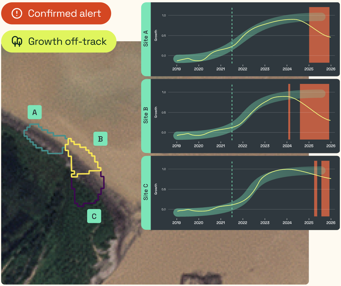
2. Timely warning of potential reversal trends: Identify problems immediately when they occur and intervene promptly before losses become inevitable.
Monthly Alert: Receive a "red" alert every month for underperforming or reversal events such as fires or deforestation.
Fine-scale visualization per hectare: Divide the site into sub plots of 1 hectare to achieve precise visualization, enabling accurate reporting and targeted action.
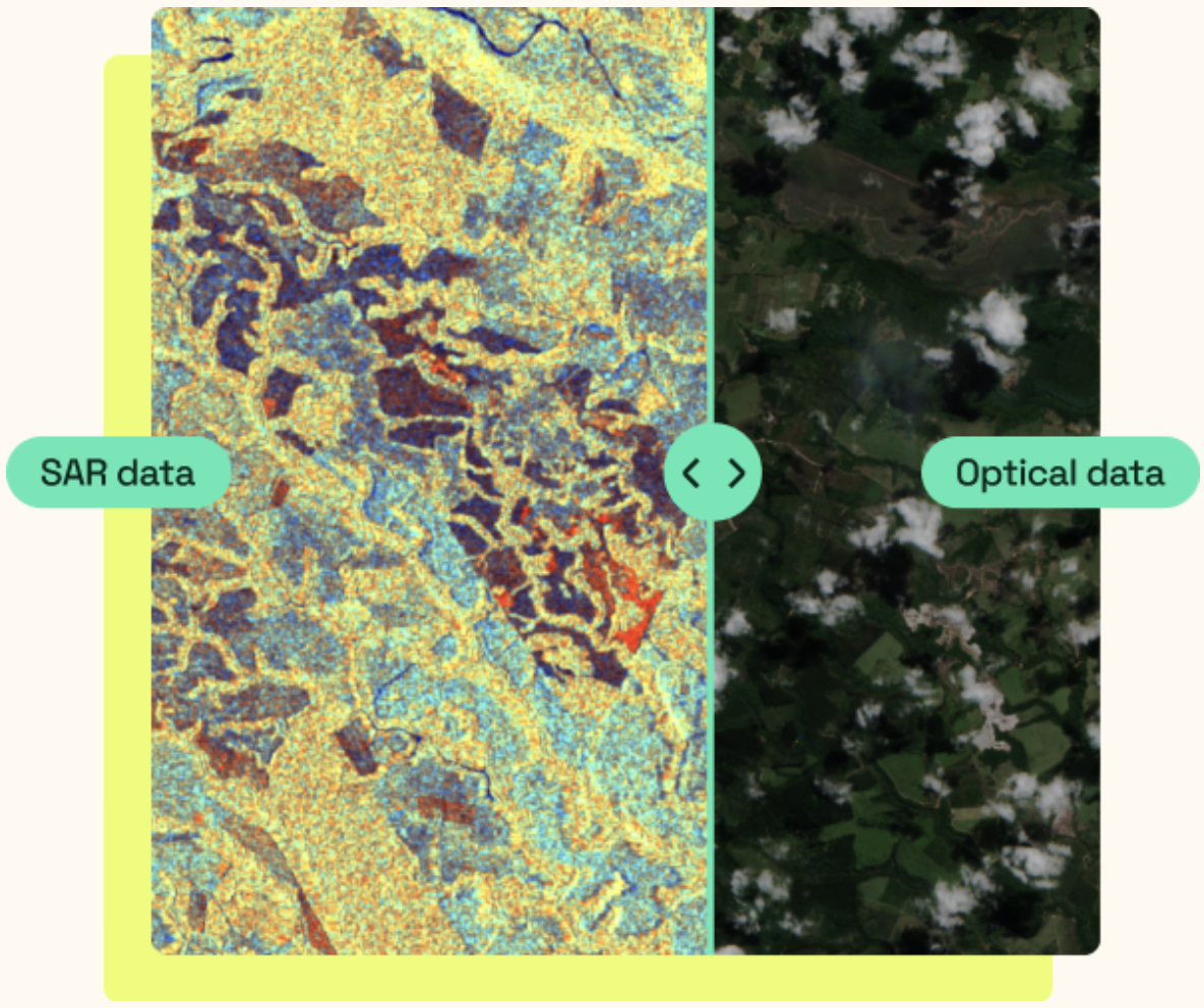
3. Relying on verifiable scientific data, ensure the consistency of the report. GrowthTracker relies on space synthetic aperture radar (SAR) data that is not affected by cloud cover.
Measuring Back-scatter: GrowthTracker uses a proprietary algorithm to compare the observed vegetation growth with the expected growth trajectory based on historical project data.
Mangrove and terrestrial forests: It have been validated in various ecological environments, including Afforestation/Reforestation (ARR) and mangrove restoration projects.
Scientific expertise: Benefiting from solutions developed by world-renowned experts with decades of experience in forest assessment and remote sensing.
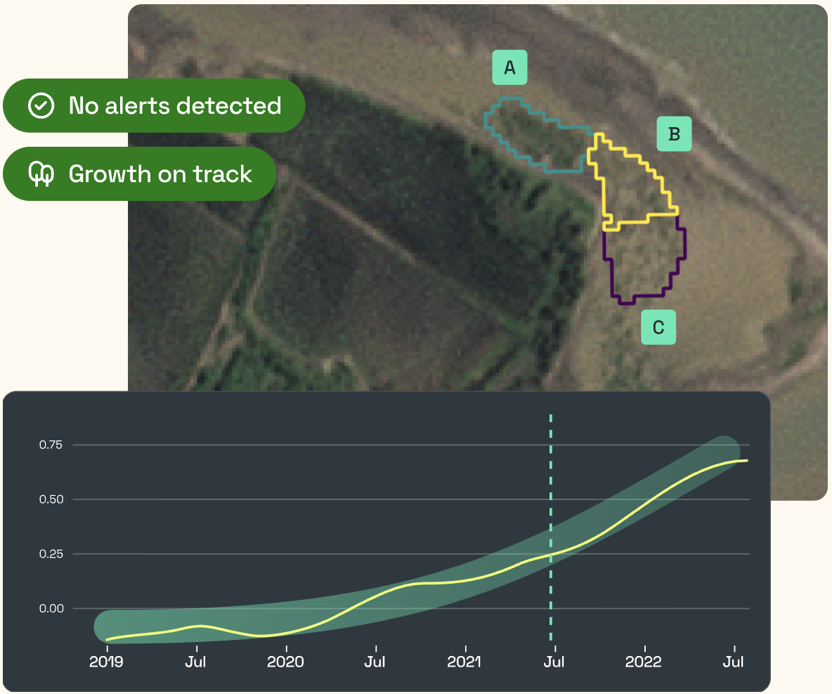
4. Support project due diligence. Verify the declaration for early-stage ARR projects and evaluate investment risks by verifying planting dates and growth history.
Historical Report: Check historical reports to confirm whether project activities actually occurred as stated in the declaration before investing.
Planting Milestones: Track the growth trajectory of existing projects to ensure they reach high integrity carbon credit milestones.